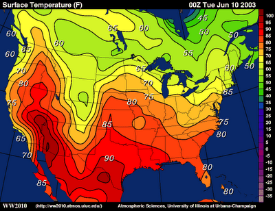
Isoline maps connect points of equal measurement with lines to separate different areas. This method can be also used to measure elevation and relief in topographic maps among other things. This map specifically uses isolines to show temperature differences across the United States.
No comments:
Post a Comment